

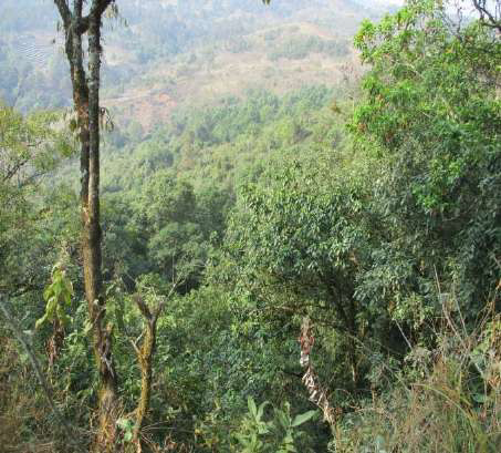
Ka Khloo Langdoh Kur Pyrtuh Sacred Grove
Khloo Langdoh kur Pyrtuh Community Reserve is situated at Sohmynting Village, of West Jaintia Hills District of Meghalaya under the care of Kur Pyrtuh. It covers an area of 15.4 ha and lies between 25° 27΄ 02˝ to 25° 27΄ 12˝ N latitude and 92° 07΄ 44˝ to 92° 08΄ 19˝ E Longitude with an altitude of 1480 m above mean sea level. The aspect of the sacred grove is in the South-West. It is bounded on all sides by private land. The grove is accessible by road from Jowai to Sohmynting Village and from the village to the sacred grove by trail. The distance from Jowai to Sohmynting is around 15 km.
About this Sacred Grove
Khloo Langdoh kur Pyrtuh Community Reserve is situated at Sohmynting Village, of West Jaintia Hills District of Meghalaya under the care of Kur Pyrtuh. It covers an area of 15.4 ha and lies between 25° 27΄ 02˝ to 25° 27΄ 12˝ N latitude and 92° 07΄ 44˝ to 92° 08΄ 19˝ E Longitude with an altitude of 1480 m above mean sea level. The aspect of the sacred grove is in the South-West. It is bounded on all sides by private land. The grove is accessible by road from Jowai to Sohmynting Village and from the village to the sacred grove by trail. The distance from Jowai to Sohmynting is around 15 km.
Castonopsis species, Machilus parviflora are mixed species.
Location
Coordinates: 25.2702000, 92.0744000
Open in Google Maps ↗Plants / Species (1)
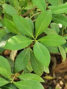
Gulmaau, Golum
Machilus parviflora- Individual Count
- 0