

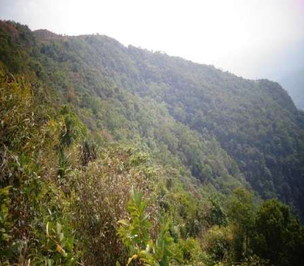
Law Adong Mawkulai Sacred Grove
Law Adong Mawkulai Sacred grove is situated in East Khasi Hills District of Meghalaya at Mawmluh village under the Mawmluh Sirdarship. It covers an area of 38.51 ha. It lies between 25° 13΄ 47" to 25° 14΄ 28˝ N latitude and 91° 42΄ 25˝ to 91° 42΄ 49˝ E Longitude with an altitude of 1149 m above mean sea level. It is bounded in the North by Wah Utim, phud Mawtyrngah stream and Wah Sylli steam, in the East by Mawmluh area, in the South by footpath (from Umwai to Wah Utim) and in the West by Umwai area. The forest is accessible by road from Shillong to Mawmluh which is about 58 km and from Mawmluh to the forest by trail which about 3.5 km.
About this Sacred Grove
Law Adong Mawkulai sacred grove is situated in East Khasi Hills District of Meghalaya at Mawmluh village under the Mawmluh Sirdarship. It covers an area of 38.51 ha. It lies between 25° 13΄ 47" to 25° 14΄ 28˝ N latitude and 91° 42΄ 25˝ to 91° 42΄ 49˝ E Longitude with an altitude of 1149 m above mean sea level. It is bounded in the North by Wah Utim, phud Mawtyrngah stream and Wah Sylli steam, in the East by Mawmluh area, in the South by footpath (from Umwai to Wah Utim) and in the West by Umwai area. The forest is accessible by road from Shillong to Mawmluh which is about 58 km and from Mawmluh to the forest by trail which about 3.5 km.
Elaeocarpus robusta species and Eugenia Jambolana as dominant species.
Location
Coordinates: 25.1347000, 91.4249000
Open in Google Maps ↗Plants / Species (1)

jamun, Java plum
Eugenia Jambolana- Individual Count
- 0